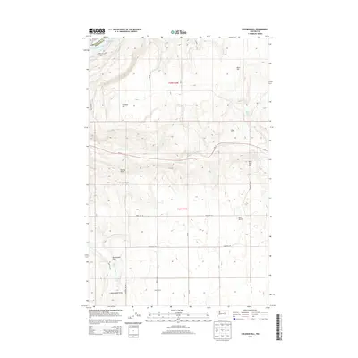
2014 Map of Coleman Hill
USGS Topo · Published 2014About this map
The Columbia River carves through the northwestern corner of this territory, where the impounded waters of Rufus Woods Lake meet a landscape of high plateaus and sharp draws. The settlement of Buckingham serves as a primary local waypoint in an area defined by its complex hydrography and varying elevations, including the prominent Coleman Hill and Pearl Hill. These heights overlook the sweeping Buckingham Flats and the descent into Buckingham Draw. Water remains the critical resource for this part of Okanogan and Douglas Counties, with features like Henton Lake, Penny Lake, and Smith Spring providing vital points for land management and local history. The road network, including Wa-17 and the various numbered roads like Road 21st Ne, reveals the intersection of modern transportation with the rugged natural terrain of the Chalk Hills and Peaceful Valley.
Find a feature on this map
34 named features on this map. Tap any name to fly to it.
Don’t see what you’re looking for? This feature index may not catch every label — zoom into the map to look around manually.
Map Details
Editions of this 2014 Coleman Hill Map
This is the sole edition of this map. No revisions or reprints were ever made.
Other maps of this area

1905 · Okanogan
USGS Topo · 1:125,000

1950 · Boot Mtn
USGS Topo · 1:62,500

1953 · Ritzville
USGS Topo · 1:250,000

1954 · Okanogan
USGS Topo · 1:250,000

1957 · Bridgeport
USGS Topo · 1:62,500

1958 · Okanogan
USGS Topo · 1:250,000

1959 · Ritzville
USGS Topo · 1:250,000

1965 · Ritzville
USGS Topo · 1:250,000

1968 · Chief Joseph Dam
USGS Topo · 1:24,000

1968 · Coleman Hill
USGS Topo · 1:24,000