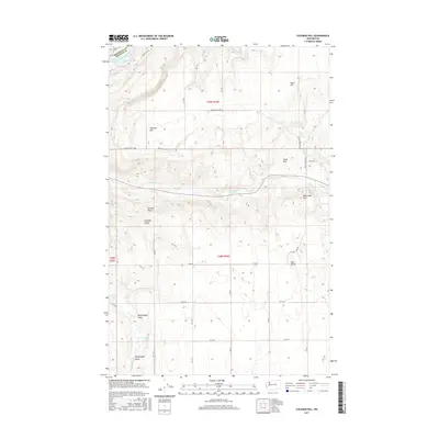
2017 Map of Coleman Hill
USGS Topo · Published 2017About this map
The Columbia River defines the northwestern corner of this territory, where it is impounded as Rufus Woods Lake along the border of Okanogan and Douglas counties. This high plateau landscape is characterized by a series of prominent elevations and named basins, including Pearl Hill, Coleman Hill, and the notably named Peaceful Valley. A network of rural roads, such as Coleman Hill Rd NE and Pearl Hill Rd, connects these upland areas, which are dissected by seasonal drainages like E Foster Cr. Local water sources are vital to this arid terrain, marked by features such as Ruben Blue Spring and Smith Spring. To the south, the terrain levels out into the Buckingham Flats near Henton Lake, providing a clear view of the land use and topographic variety typical of this region's rural geography.
Find a feature on this map
36 named features on this map. Tap any name to fly to it.
Don’t see what you’re looking for? This feature index may not catch every label — zoom into the map to look around manually.
Map Details
Editions of this 2017 Coleman Hill Map
This is the sole edition of this map. No revisions or reprints were ever made.
Other maps of this area

1905 · Okanogan
USGS Topo · 1:125,000

1950 · Boot Mtn
USGS Topo · 1:62,500

1953 · Ritzville
USGS Topo · 1:250,000

1954 · Okanogan
USGS Topo · 1:250,000

1957 · Bridgeport
USGS Topo · 1:62,500

1958 · Okanogan
USGS Topo · 1:250,000

1959 · Ritzville
USGS Topo · 1:250,000

1965 · Ritzville
USGS Topo · 1:250,000

1968 · Chief Joseph Dam
USGS Topo · 1:24,000

1968 · Coleman Hill
USGS Topo · 1:24,000