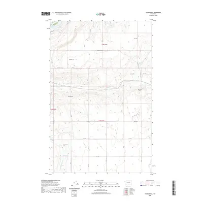
2020 Map of Coleman Hill
USGS Topo · Published 2020About this map
Rufus Woods Lake marks the northwestern edge of this high-plateau landscape where Okanogan Co and Douglas Co meet. The terrain is defined by a series of prominent elevations and seasonal drainages, most notably the namesake Coleman Hill and the distinctive Chalk Hills. This area in Central Washington is characterized by a network of rural roads such as Coleman Hill Rd NE and Pearl Hill Rd, which navigate the rises between Stormy Point and Mary Jane Hill. The drainage patterns of E Foster Cr and Middle Foster Cr provide a look at the natural watershed before the land descends toward Buckingham Flats. Scattered water sources like Ruben Blue Spring and small, high-altitude bodies such as Penny Lake and Henton Lake are critical landmarks in this arid environment, often associated with early grazing or settlement sites.
Find a feature on this map
32 named features on this map. Tap any name to fly to it.
Don’t see what you’re looking for? This feature index may not catch every label — zoom into the map to look around manually.
Map Details
Editions of this 2020 Coleman Hill Map
This is the sole edition of this map. No revisions or reprints were ever made.
Other maps of this area

1905 · Okanogan
USGS Topo · 1:125,000

1950 · Boot Mtn
USGS Topo · 1:62,500

1953 · Ritzville
USGS Topo · 1:250,000

1954 · Okanogan
USGS Topo · 1:250,000

1957 · Bridgeport
USGS Topo · 1:62,500

1958 · Okanogan
USGS Topo · 1:250,000

1959 · Ritzville
USGS Topo · 1:250,000

1965 · Ritzville
USGS Topo · 1:250,000

1968 · Chief Joseph Dam
USGS Topo · 1:24,000

1968 · Coleman Hill
USGS Topo · 1:24,000