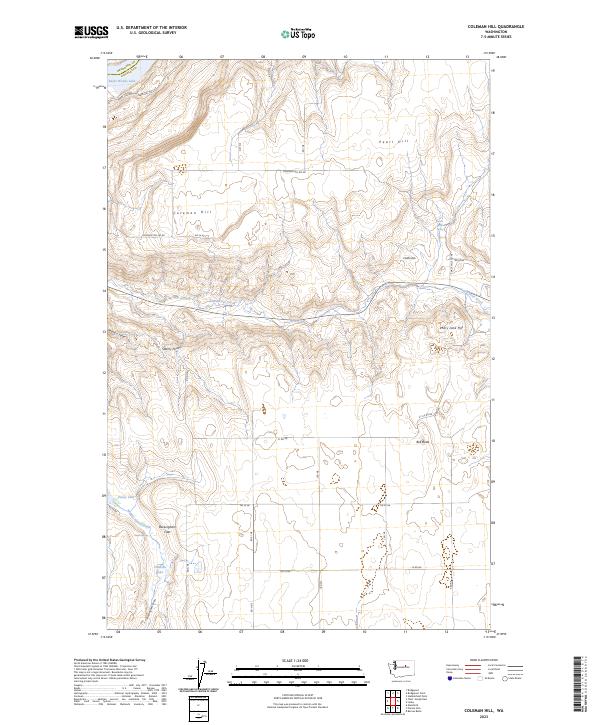
2023 Map of Coleman Hill
USGS Topo · Published 2023About this map
The plateau and coulée landscape of northern Douglas County is defined by the sharp descent toward Rufus Woods Lake along the county boundary. This high desert terrain is punctuated by significant rises such as Pearl Hill, Coleman Hill, and the Chalk Hills, while the drainage of East Foster Creek carves through the central portion of the quadrangle. The map reveals a land utilized for its scattered water resources, with named sites like Smith Spring and Ruben Blue Spring supporting life in a dry environment. A network of rural section-line roads, including Coleman Hill Rd NE and Rd 20 NE, connect the isolated landscape features. The presence of Buckingham Flats and Stormy Point suggests the varied topography that local ranchers and land managers have long navigated in this portion of the Washington interior.
Find a feature on this map
30 named features on this map. Tap any name to fly to it.
Don’t see what you’re looking for? This feature index may not catch every label — zoom into the map to look around manually.
Map Details
Editions of this 2023 Coleman Hill Map
This is the sole edition of this map. No revisions or reprints were ever made.
Other maps of this area

1905 · Okanogan
USGS Topo · 1:125,000

1950 · Boot Mtn
USGS Topo · 1:62,500

1953 · Ritzville
USGS Topo · 1:250,000

1954 · Okanogan
USGS Topo · 1:250,000

1957 · Bridgeport
USGS Topo · 1:62,500

1958 · Okanogan
USGS Topo · 1:250,000

1959 · Ritzville
USGS Topo · 1:250,000

1965 · Ritzville
USGS Topo · 1:250,000

1968 · Chief Joseph Dam
USGS Topo · 1:24,000

1968 · Coleman Hill
USGS Topo · 1:24,000