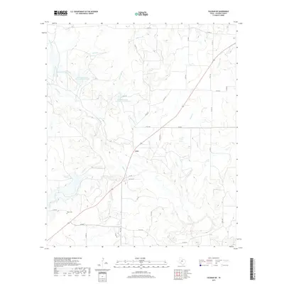
2019 Map of Coleman NE
USGS Topo · Published 2019About this map
Echo sits at a geographic crossroads in northern Coleman County, where the modern path of State Highway 206 meets a network of Farm to Market roads. This rural landscape is defined by its watershed management, evidenced by multiple flood control structures like Soil Conservation Service Site 7 Reservoir and Soil Conservation Service Site 5 Reservoir. These man-made features sit among the natural drainages of Jim Ned Cr and Indian Cr, reflecting a mid-to-late 20th-century approach to land and water conservation in Central Texas. For those researching family history, the Walker Cem remains a significant landmark near the intersection of Co RD 142, preserved amidst the winding courses of Crooked Cr and Betty Logan Cr. The terrain is marked by numerous named branches, including Deadman Br and Wilkerson Br, which feed into the primary creek systems.
Find a feature on this map
36 named features on this map. Tap any name to fly to it.
Don’t see what you’re looking for? This feature index may not catch every label — zoom into the map to look around manually.
Map Details
Editions of this 2019 Coleman NE Map
This is the sole edition of this map. No revisions or reprints were ever made.
Other maps of this area

1887 · Coleman
USGS Topo · 1:125,000

1889 · Coleman
USGS Topo · 1:125,000

1924 · Brownwood Reservoir Site
USGS Topo · 1:48,000

1927 · Grosvenor
USGS Topo · 1:62,500

1931 · Baird
USGS Topo · 1:125,000

1932 · Baird
USGS Topo · 1:125,000

1954 · Brownwood
USGS Topo · 1:250,000

1954 · Abilene
USGS Topo · 1:250,000

1958 · Abilene
USGS Topo · 1:250,000

1960 · Lake Scarborough
USGS Topo · 1:24,000