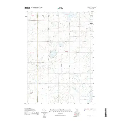
2019 Map of Coleman NE
USGS Topo · Published 2019About this map
The Middle Branch Tobacco River and North Branch Tobacco River define the drainage of this Gladwin County landscape, converging south of the seat of Gladwin. This modern survey reveals a region shaped by its glacial hydrology, featuring a cluster of distinct water bodies such as Kerswill Lake, Wiggins Lake, and the uniquely named Big Lake Twenty. The land is organized by a precise grid of county roads, while legacy infrastructure is visible in the Railroad Grade near the southern edge of the sheet. For those researching local heritage, the map identifies significant sites such as Grout Cem and the Beaverton City Cem near Ross Lake. The terrain is marked by numerous drainage features like Lucas Drain and Burleson Drain, illustrating the ongoing efforts to manage the wetlands and low-lying areas characteristic of central Michigan.
Find a feature on this map
91 named features on this map. Tap any name to fly to it.
Don’t see what you’re looking for? This feature index may not catch every label — zoom into the map to look around manually.
Map Details
Editions of this 2019 Coleman NE Map
This is the sole edition of this map. No revisions or reprints were ever made.
Other maps of this area

1954 · Traverse City
USGS Topo · 1:250,000

1954 · Midland
USGS Topo · 1:250,000

1958 · Traverse City
USGS Topo · 1:250,000

1958 · Midland
USGS Topo · 1:250,000

1959 · Midland
USGS Topo · 1:250,000

1966 · Midland
USGS Topo · 1:250,000

1969 · Wagarville
USGS Topo · 1:24,000

1969 · Meredith SW
USGS Topo · 1:24,000

1969 · Gladwin
USGS Topo · 1:24,000

1969 · Coleman
USGS Topo · 1:24,000