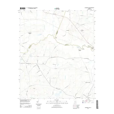
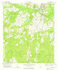
2014 Map of Colemans Lake
USGS Topo · Published 2014About this map
The Ogeechee River snakes through this rural landscape at the junction of Jefferson, Burke, and Emanuel counties, marking a terrain defined by bottomland swamps and small upland settlements. Around Colemans Lake and the area of Seven Cypresses, the land falls away from the sandy ridges toward the river basin, where Franklins Bluff stands as a notable landmark near Midville. The map reveals a pattern of scattered homesteads and small communities like Cunningham Corner, Gertrude, and Summertown, many of which are anchored by family-named cemeteries.
Find a feature on this map
73 named features on this map. Tap any name to fly to it.
Don’t see what you’re looking for? This feature index may not catch every label — zoom into the map to look around manually.
Map Details
Editions of this 2014 Colemans Lake Map
This is the sole edition of this map. No revisions or reprints were ever made.
Other maps of this area

1957 · Macon
USGS Topo · 1:250,000

1958 · Macon
USGS Topo · 1:250,000

1964 · Macon
USGS Topo · 1:250,000

1971 · Dellwood
USGS Topo · 1:24,000
1971 · Canoochee
USGS Topo · 1:24,000

1971 · Summertown
USGS Topo · 1:24,000
1973 · Louisville South
USGS Topo · 1:24,000
1973 · Old Town
USGS Topo · 1:24,000

1973 · Colemans Lake
USGS Topo · 1:24,000
1973 · Wadley
USGS Topo · 1:24,000