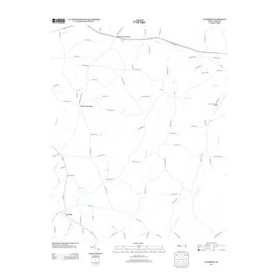
2013 Map of Coleridge
USGS Topo · Published 2013About this map
The Deep River winds through the southwestern corner of this landscape, defining the rural character of southeastern Randolph County. The small community of Coleridge sits near its banks, serving as a historic hub for the surrounding agricultural network. Moving northward, the terrain is shaped by an intricate system of tributaries including Brush Creek and the curiously named Blood Run, which flow through a region marked by crossroads settlements like Browns Crossroads and Parks Crossroads. The road network is heavily influenced by legacy land ownership, with routes such as Parks Xroads Church Rd and Kildee Church Rd suggesting the central role of community institutions. In the northeast, the Siler City Municipal Airport stands as a modern landmark, signaling the proximity of regional infrastructure to these traditional Piedmont farmsteads and creek valleys.
Find a feature on this map
75 named features on this map. Tap any name to fly to it.
Don’t see what you’re looking for? This feature index may not catch every label — zoom into the map to look around manually.
Map Details
Editions of this 2013 Coleridge Map
This is the sole edition of this map. No revisions or reprints were ever made.
Other maps of this area

1953 · Raleigh
USGS Topo · 1:250,000

1954 · Raleigh
USGS Topo · 1:250,000

1968 · Ramseur
USGS Topo · 1:24,000

1968 · Coleridge
USGS Topo · 1:24,000

1968 · Erect
USGS Topo · 1:24,000

1968 · Bennett
USGS Topo · 1:24,000

1969 · Siler City
USGS Topo · 1:24,000

1970 · Bear Creek
USGS Topo · 1:24,000

1974 · Crutchfield Crossroads
USGS Topo · 1:24,000
1974 · Grays Chapel
USGS Topo · 1:24,000