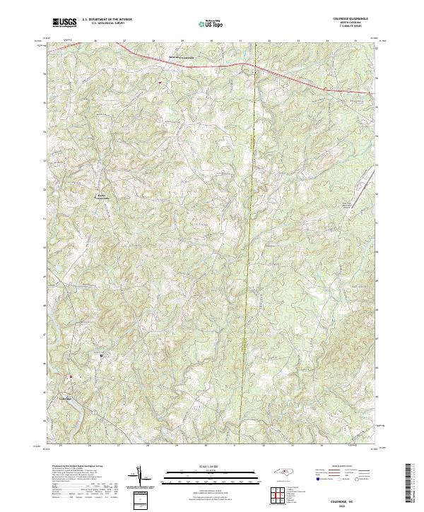
2022 Map of Coleridge
USGS Topo · Published 2022About this map
Coleridge and its surrounding rural hamlets are documented in this recent survey of the Randolph Co and Chatham Co border. The landscape is defined by the winding course of the Deep River in the southwest and a network of named tributaries including Brush Cr and Blood Run. The map highlights long-established junctions like Browns Crossroads and Parks Crossroads, which serve as focal points for a dense grid of family-named roads such as Roby Coe Rd and Hicks Farm Rd. Significant local landmarks include Concord Cem and the Siler City Municipal Airport near the eastern edge. The topography is characterized by subtle rises like Sunset Hill, while Peavine Lake provides a notable water feature in the northern section. This record serves as a precise guide for tracing contemporary property boundaries and local road development in this part of the North Carolina Piedmont.
Find a feature on this map
71 named features on this map. Tap any name to fly to it.
Don’t see what you’re looking for? This feature index may not catch every label — zoom into the map to look around manually.
Map Details
Editions of this 2022 Coleridge Map
This is the sole edition of this map. No revisions or reprints were ever made.
Other maps of this area

1953 · Raleigh
USGS Topo · 1:250,000

1954 · Raleigh
USGS Topo · 1:250,000

1968 · Ramseur
USGS Topo · 1:24,000

1968 · Coleridge
USGS Topo · 1:24,000

1968 · Erect
USGS Topo · 1:24,000

1968 · Bennett
USGS Topo · 1:24,000

1969 · Siler City
USGS Topo · 1:24,000

1970 · Bear Creek
USGS Topo · 1:24,000

1974 · Crutchfield Crossroads
USGS Topo · 1:24,000
1974 · Grays Chapel
USGS Topo · 1:24,000