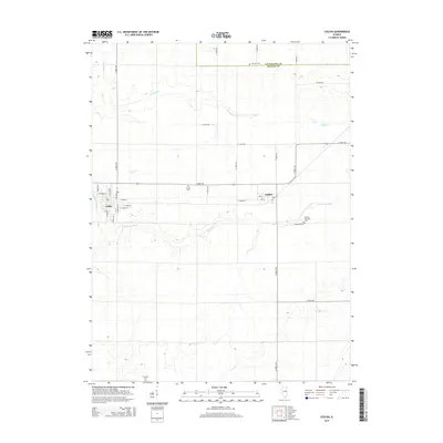
2015 Map of Colfax
USGS Topo · Published 2015About this map
The Mackinaw River meanders through the heart of this central Illinois landscape, defining the topography south of Colfax and Anchor. In this agricultural region near the Livingston and McLean county line, the map documents a network of rural roads and small-town street grids. Local heritage is preserved in the placement of numerous burial grounds, including the Antioch Cem located along E 2000 N Rd and the Anchor Township Cem situated further east. Several watercourses, including Henline Cr and Colfax Cr, drain the surrounding fields. The street details in Colfax itself, from E Main St to S Grove St, show the layout of this community as it appeared in the early 21st century.
Find a feature on this map
37 named features on this map. Tap any name to fly to it.
Don’t see what you’re looking for? This feature index may not catch every label — zoom into the map to look around manually.
Map Details
Editions of this 2015 Colfax Map
This is the sole edition of this map. No revisions or reprints were ever made.
Other maps of this area

1928 · Gibson City
USGS Topo · 1:62,500

1947 · Sibley
USGS Topo · 1:62,500

1949 · Sibley
USGS Topo · 1:62,500

1952 · Arrowsmith
USGS Topo · 1:62,500

1957 · Gibson City
USGS Topo · 1:62,500

1957 · Colfax
USGS Topo · 1:62,500

1958 · Peoria
USGS Topo · 1:250,000

1961 · Peoria
USGS Topo · 1:250,000

1963 · Peoria
USGS Topo · 1:250,000
1982 · Gibson City West
USGS Topo · 1:24,000