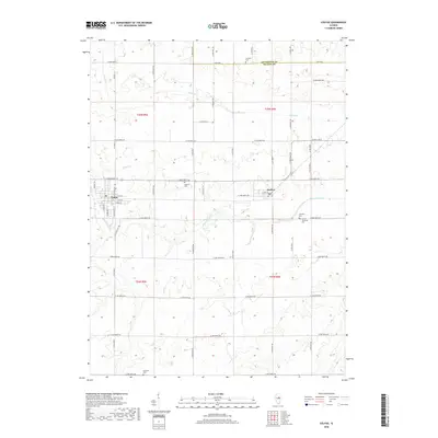
2018 Map of Colfax
USGS Topo · Published 2018About this map
Colfax and Anchor serve as the primary hubs of this agricultural landscape in eastern McLean County. The terrain is defined by the winding course of the Mackinaw River and its tributaries, including Henline Cr and Colfax Cr, which cut through a dense grid of rural roads. This network of thoroughfares, such as Co Hwy 13 and E 2000 North Rd, connects numerous burial grounds that provide important links to the area's pioneer history, including Fairview Cem, Antioch Cem, and Plymouth Cem. The presence of multiple cemeteries, such as the Anchor Township Cem, alongside established town centers reflects a long-standing pattern of dispersed prairie settlement and local township organization typical of central Illinois.
Find a feature on this map
57 named features on this map. Tap any name to fly to it.
Don’t see what you’re looking for? This feature index may not catch every label — zoom into the map to look around manually.
Map Details
Editions of this 2018 Colfax Map
This is the sole edition of this map. No revisions or reprints were ever made.
Other maps of this area

1928 · Gibson City
USGS Topo · 1:62,500

1947 · Sibley
USGS Topo · 1:62,500

1949 · Sibley
USGS Topo · 1:62,500

1952 · Arrowsmith
USGS Topo · 1:62,500

1957 · Gibson City
USGS Topo · 1:62,500

1957 · Colfax
USGS Topo · 1:62,500

1958 · Peoria
USGS Topo · 1:250,000

1961 · Peoria
USGS Topo · 1:250,000

1963 · Peoria
USGS Topo · 1:250,000
1982 · Gibson City West
USGS Topo · 1:24,000