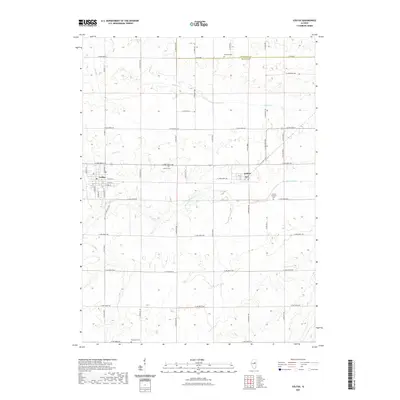
2021 Map of Colfax
USGS Topo · Published 2021About this map
Colfax and the neighboring settlement of Anchor anchor this study of north-central Illinois, where the section-line road grid organizes a landscape defined by drainage and agriculture. The Mackinaw River winds eastward across the center of the sheet, joined by tributaries like Colfax Cr and Henline Cr. This network of waterways creates subtle relief in the otherwise steady elevation of the Illinois prairie.
Find a feature on this map
53 named features on this map. Tap any name to fly to it.
Don’t see what you’re looking for? This feature index may not catch every label — zoom into the map to look around manually.
Map Details
Editions of this 2021 Colfax Map
This is the sole edition of this map. No revisions or reprints were ever made.
Other maps of this area

1928 · Gibson City
USGS Topo · 1:62,500

1947 · Sibley
USGS Topo · 1:62,500

1949 · Sibley
USGS Topo · 1:62,500

1952 · Arrowsmith
USGS Topo · 1:62,500

1957 · Gibson City
USGS Topo · 1:62,500

1957 · Colfax
USGS Topo · 1:62,500

1958 · Peoria
USGS Topo · 1:250,000

1961 · Peoria
USGS Topo · 1:250,000

1963 · Peoria
USGS Topo · 1:250,000
1982 · Gibson City West
USGS Topo · 1:24,000