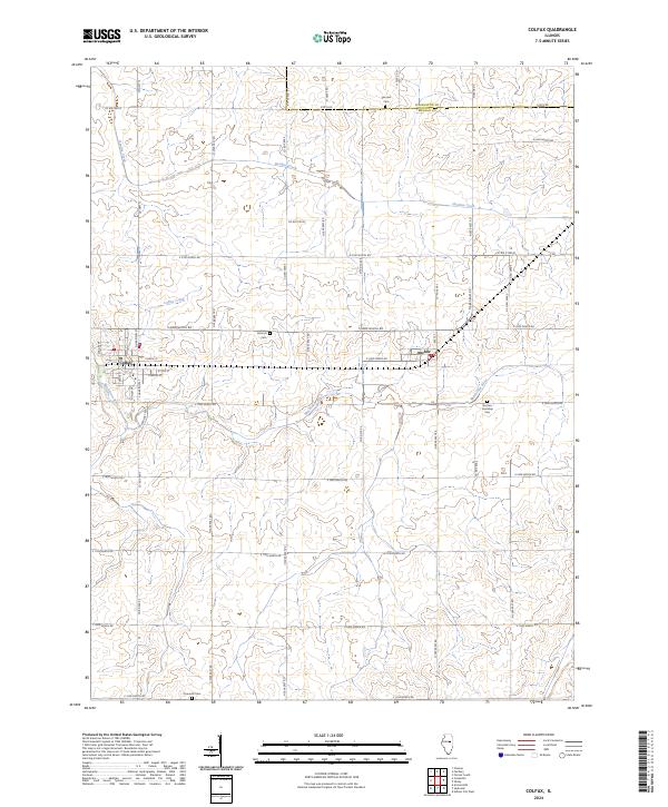
2024 Map of Colfax
USGS Topo · Published 2024About this map
The agricultural landscape of eastern McLean County is defined by the headwaters of the Mackinaw River and its tributaries, which carve subtle relief into the prairie. The village of Colfax serves as the primary hub, showing a grid of residential streets like E Main St and S Grove St north of the river. To the east, the smaller settlement of Anchor sits near the Anchor Township Cem, maintaining its identity amidst a sprawling network of section roads. This survey records the persistent rural character of the region, where family history is anchored by localized landmarks such as Antioch Cem and Fairview Cem. The drainage patterns of Henline Creek and Colfax Creek illustrate the natural topography that dictated early farm placement and road alignments long before modern paving followed these historic township lines.
Find a feature on this map
52 named features on this map. Tap any name to fly to it.
Don’t see what you’re looking for? This feature index may not catch every label — zoom into the map to look around manually.
Map Details
Editions of this 2024 Colfax Map
This is the sole edition of this map. No revisions or reprints were ever made.
Other maps of this area

1928 · Gibson City
USGS Topo · 1:62,500

1947 · Sibley
USGS Topo · 1:62,500

1949 · Sibley
USGS Topo · 1:62,500

1952 · Arrowsmith
USGS Topo · 1:62,500

1957 · Gibson City
USGS Topo · 1:62,500

1957 · Colfax
USGS Topo · 1:62,500

1958 · Peoria
USGS Topo · 1:250,000

1961 · Peoria
USGS Topo · 1:250,000

1963 · Peoria
USGS Topo · 1:250,000
1982 · Gibson City West
USGS Topo · 1:24,000