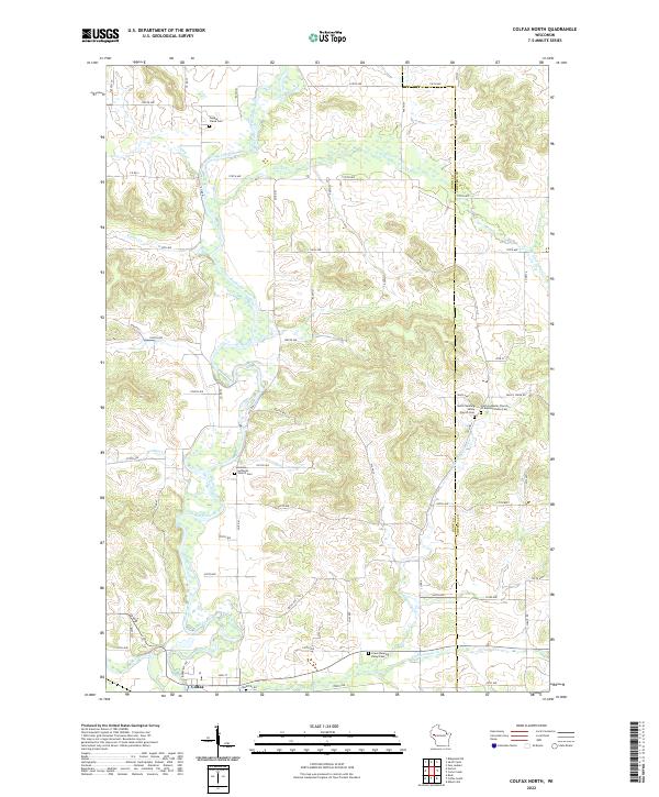
2022 Map of Colfax North
USGS Topo · Published 2022About this map
The Red Cedar River carves a winding path through this portion of western Wisconsin, defining a landscape of deep valleys and rising terrain like Bronken Hill. The area is characterized by several distinct rural congregations and their associated burial grounds, which serve as central points for local genealogy and heritage. Key sites include Holden Lutheran Church and its Holden Lutheran Cem, alongside the North Running Valley Church and the Faith Lutheran Church of Running Valley. Tributaries such as Trout Cr, Popple Cr, and Running Valley Cr feed into the main river system, creating a network of drainage that influenced early road placement. At the southern edge, the village of Colfax sits near the confluence of Eighteenmile Cr, marking the primary settlement hub for the surrounding agricultural townships.
Find a feature on this map
69 named features on this map. Tap any name to fly to it.
Don’t see what you’re looking for? This feature index may not catch every label — zoom into the map to look around manually.
Map Details
Editions of this 2022 Colfax North Map
This is the sole edition of this map. No revisions or reprints were ever made.
Other maps of this area

1934 · Elk Mound
USGS Topo · 1:62,500

1936 · Elk Mound
USGS Topo · 1:62,500

1940 · Menomonie
USGS Topo · 1:62,500

1942 · Menomonie
USGS Topo · 1:62,500

1949 · New Auburn
USGS Topo · 1:62,500

1949 · Ridgeland
USGS Topo · 1:62,500

1951 · Ridgeland
USGS Topo · 1:62,500

1951 · New Auburn
USGS Topo · 1:62,500

1953 · Eau Claire
USGS Topo · 1:250,000

1953 · Rice Lake
USGS Topo · 1:250,000