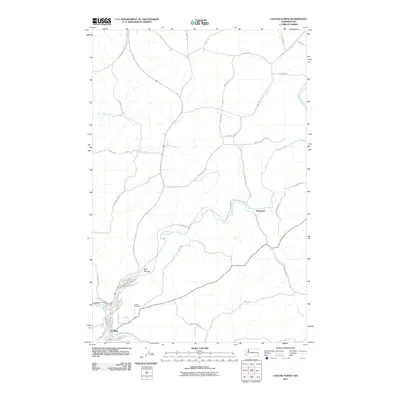
2011 Map of Colfax North
USGS Topo · Published 2011About this map
Colfax and its surrounding agricultural highlands are defined by the winding course of the Palouse River and the South Fork Palouse River. This 2011 survey illustrates a region where narrow valley settlements meet a vast network of canyon-rimmed plateaus, typical of the Palouse landscape. Local history is anchored at the Colfax Cemetery and the northern residential streets of the town, including N Oak St and Cedar St. To the northeast, the smaller settlement of Glenwood sits along Clear Creek, connected by a web of rural routes named for the families who worked this land, such as Brose Cutoff Rd, Mullen Rd, and Bill Wilson Rd. The topography is marked by significant drainage patterns like Buck Canyon and Dry Creek, which carve through the high-desert wheat country.
Find a feature on this map
45 named features on this map. Tap any name to fly to it.
Don’t see what you’re looking for? This feature index may not catch every label — zoom into the map to look around manually.
Map Details
Editions of this 2011 Colfax North Map
This is the sole edition of this map. No revisions or reprints were ever made.
Other maps of this area

1903 · Oakesdale
USGS Topo · 1:125,000

1905 · Oakesdale
USGS Topo · 1:125,000

1910 · Pullman
USGS Topo · 1:125,000

1955 · Pullman
USGS Topo · 1:250,000

1955 · Spokane
USGS Topo · 1:250,000

1958 · Spokane
USGS Topo · 1:250,000

1958 · Pullman
USGS Topo · 1:250,000

1964 · Diamond
USGS Topo · 1:24,000

1964 · Elberton
USGS Topo · 1:24,000

1964 · Colfax North
USGS Topo · 1:24,000