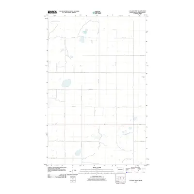
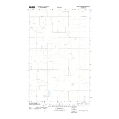
2011 Map of Colgan West
USGS Topo · Published 2011About this map
Colgan sits near the eastern edge of this Divide County landscape, positioned within a vast grid of section roads just south of the international border with Saskatchewan. The terrain is defined by numerous small depressions and water bodies, most notably Goose Lake in the north-central portion of the quadrangle. This 2011 survey documents a sparsely settled agricultural region where the rectilinear transport network, including 109th St NW and 140th Ave NW, provides the primary structure for the landscape. Apart from the cluster at Colgan, the area is characterized by open prairie and intermittent wetlands, with County Hwy-3 serving as a significant north-south corridor through the center of the township.
Find a feature on this map
17 named features on this map. Tap any name to fly to it.
Don’t see what you’re looking for? This feature index may not catch every label — zoom into the map to look around manually.
Map Details
Editions of this 2011 Colgan West Map
This is the sole edition of this map. No revisions or reprints were ever made.
Other maps of this area

1953 · Williston
USGS Topo · 1:250,000

1957 · Williston
USGS Topo · 1:250,000

1983 · Colgan West
USGS Topo · 1:24,000

1983 · Writing Rock North
USGS Topo · 1:24,000

1983 · Alexandria
USGS Topo · 1:24,000
1983 · Fortuna
USGS Topo · 1:24,000
1983 · Colgan East
USGS Topo · 1:24,000
1983 · Colgan SE
USGS Topo · 1:24,000

1984 · Crosby
USGS Topo · 1:100,000
2011 · Writing Rock North
USGS Topo · 1:24,000