
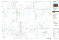
1984 Map of Crosby
USGS Topo · Published 1984About this map
Crosby serves as a vital hub in the northwestern corner of North Dakota, positioned near the international border with Canada. This 1980s landscape is defined by its vast network of prairie potholes and wetlands, including the National Wildlife Refuge and Blue Ridge State Wildlife Management Area. The region's transport history is visible through the Soo Line railroad and the Old Bounty Railroad Grade, which once connected smaller agricultural settlements like Noonan, Ambrose, and Fortuna.
Find a feature on this map
112 named features on this map. Tap any name to fly to it.
Don’t see what you’re looking for? This feature index may not catch every label — zoom into the map to look around manually.
Map Details
Editions of this 1984 Crosby Map
2 editions found
Other maps of this area

1911 · Ray
USGS Topo · 1:125,000

1946 · Brush Lake
USGS Topo · 1:24,000

1947 · Noonan
USGS Topo · 1:24,000

1948 · Grenora
USGS Topo · 1:24,000

1948 · Smoky Butte
USGS Topo · 1:24,000

1948 · Alamo N.E.
USGS Topo · 1:24,000

1948 · Hanks
USGS Topo · 1:24,000

1948 · Crosby SW
USGS Topo · 1:24,000

1948 · Ambrose
USGS Topo · 1:24,000

1948 · Stady
USGS Topo · 1:24,000