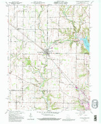
1992 Map of College Corner
USGS Topo · Published 1995About this map
College Corner straddles the state line between Indiana and Ohio, anchoring a landscape defined by small crossroads settlements and a dense network of country roads. During the late twentieth century, this region remained predominantly agricultural, with the CSX Transportation line and historic routes like Velocipede Pike connecting the rural townships of Union, Israel, and Bath. The eastern portion of the map is dominated by the waters of Acton Lake within Hueston Woods State Park, a significant recreational area near the Mil Res and Miami University Airfield.
Find a feature on this map
47 named features on this map. Tap any name to fly to it.
Don’t see what you’re looking for? This feature index may not catch every label — zoom into the map to look around manually.
Map Details
Editions of this 1992 College Corner Map
This is the sole edition of this map. No revisions or reprints were ever made.
Other maps of this area

1911 · Oxford
USGS Topo · 1:62,500

1915 · College Corner
USGS Topo · 1:48,000

1915 · Harrison
USGS Topo · 1:48,000

1915 · Hamilton
USGS Topo · 1:62,500

1917 · Hamilton
USGS Topo · 1:62,500

1918 · College Corner
USGS Topo · 1:62,500

1948 · Fairfield
USGS Topo · 1:24,000

1953 · Cincinnati
USGS Topo · 1:250,000

1955 · Reily
USGS Topo · 1:24,000

1955 · Mount Carmel
USGS Topo · 1:24,000