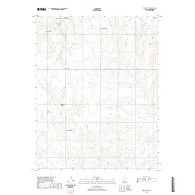
2020 Map of Collet Top
USGS Topo · Published 2020About this map
Kaiparowits Plateau and its dramatic Straight Cliffs dominate this portion of the high desert, where deep drainage systems have carved a complex labyrinth of sandstone. The high point at Collet Top provides an orienting landmark above a series of named ravines, including Left Hand Collet Canyon and Lower Trail Canyon. This landscape reveals a long history of cattle-country nomenclature, seen in features like Horse Canyon, Steer Canyon, and Cigar Creek Canyon. Rare water sources in this arid environment are noted at Circle Spring and along Willow Gulch. The map illustrates the extreme topography of the western plateau edge, where massive landforms like Window Sash Bench stand isolated between deep canyons such as Button Canyon and Rogers Canyon.
Find a feature on this map
14 named features on this map. Tap any name to fly to it.
Don’t see what you’re looking for? This feature index may not catch every label — zoom into the map to look around manually.
Map Details
Editions of this 2020 Collet Top Map
This is the sole edition of this map. No revisions or reprints were ever made.
Other maps of this area

1886 · Escalante
USGS Topo · 1:250,000

1922 · Upper Last Chance
USGS Topo · 1:63,360

1922 · Rees Canyon
USGS Topo · 1:63,360

1956 · Escalante
USGS Topo · 1:250,000

1960 · Escalante
USGS Topo · 1:250,000

1964 · Sunset Flat
USGS Topo · 1:24,000

1964 · Seep Flat
USGS Topo · 1:24,000

1964 · Carcass Canyon
USGS Topo · 1:24,000

1968 · East of The Navajo
USGS Topo · 1:24,000
1968 · Petes Cove
USGS Topo · 1:24,000