
1966 Map of Collett Springs
USGS Topo · Published 1968About this map
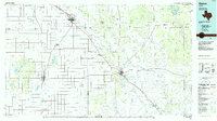
Collett Springs and the winding course of the White River anchor this mid-1960s topographic study of the Texas Caprock escarpment. The landscape is defined by the sharp transition between the level High Plains to the west and the deeply eroded breaks to the east. Water management is the primary human footprint on this terrain, evidenced by a network of windmills such as Spindle Top Windmill, North Windmill, and East Herd Windmill, alongside numerous livestock tanks like Rock Trail Tank and Big Bull Tank. A prominent Aqueduct traverses the northern section, highlighting the infrastructure required to move water across this arid region. The map also documents small-scale industrial sites, including a Claypit and Gravel Pit near the southern edge, while natural landmarks like the Blue Hole and the heights of Indian Hill provide clear orientation points within the rugged draws of Sand Rock Creek and Davidson Creek.
Find a feature on this map
22 named features on this map. Tap any name to fly to it.
Don’t see what you’re looking for? This feature index may not catch every label — zoom into the map to look around manually.
Map Details
Editions of this 1966 Collett Springs Map
This is the sole edition of this map. No revisions or reprints were ever made.
Other maps of this area

1954 · Lubbock
USGS Topo · 1:250,000

1961 · Bunker Hill
USGS Topo · 1:24,000

1962 · Smith Tank
USGS Topo · 1:24,000

1966 · Crosbyton
USGS Topo · 1:24,000

1966 · Kalgary
USGS Topo · 1:24,000

1966 · McAdoo
USGS Topo · 1:24,000

1966 · Canyon Valley
USGS Topo · 1:24,000

1967 · Ralls SE
USGS Topo · 1:24,000

1967 · Ralls NE
USGS Topo · 1:24,000
1986 · Slaton
USGS Topo · 1:100,000