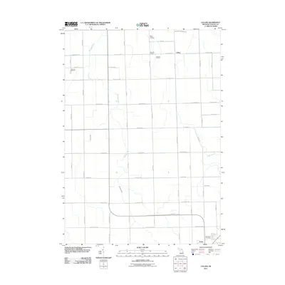
2011 Map of Colling
USGS Topo · Published 2011About this map
Caro anchors the southern portion of this agricultural landscape in Tuscola County, where the sprawling campus of Davenport University sits near the edge of town. The area is defined by a grid of farm roads and a complex network of managed waterways, including the Wiscoggin Drain and its various tributaries like Gilbert Branch and Humes Branch. These drainage systems are central to the region’s heritage as a productive farming district. Smaller settlements like Colling and Columbia Corners serve as local landmarks, while the presence of three distinct burial grounds—Saint Peters Cemetery, Columbia Cemetery, and Demorest Cemetery—offers valuable points of reference for genealogists tracing family histories in the rural townships north of the county seat.
Find a feature on this map
47 named features on this map. Tap any name to fly to it.
Don’t see what you’re looking for? This feature index may not catch every label — zoom into the map to look around manually.
Map Details
Editions of this 2011 Colling Map
This is the sole edition of this map. No revisions or reprints were ever made.
Other maps of this area

1954 · Flint
USGS Topo · 1:250,000

1958 · Flint
USGS Topo · 1:250,000

1963 · Fish Point
USGS Topo · 1:24,000

1963 · East Dayton
USGS Topo · 1:24,000

1963 · Fairgrove
USGS Topo · 1:24,000

1963 · Ellington
USGS Topo · 1:24,000

1963 · Gilford
USGS Topo · 1:24,000

1963 · Caro
USGS Topo · 1:24,000

1963 · Owendale
USGS Topo · 1:24,000

1963 · Colling
USGS Topo · 1:24,000