
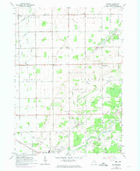
1963 Map of Gilford
USGS Topo · Published 1964About this map
The Cass River meanders through the southern portion of this Tuscola County landscape, anchoring a region defined by its complex drainage network and rural settlements in the early 1960s. The Vassar State Game Area dominates the southeast quadrant, preserving a pocket of terrain characterized by Odessa Lakes and numerous sandpits. Settlement patterns follow the grid of sections, with agricultural life centered around places like Watrousville, where the Watrousville Cem and a nearby Landing Field are located.
Find a feature on this map
58 named features on this map. Tap any name to fly to it.
Don’t see what you’re looking for? This feature index may not catch every label — zoom into the map to look around manually.
Map Details
Editions of this 1963 Gilford Map
2 editions found
Other maps of this area

1954 · Flint
USGS Topo · 1:250,000

1958 · Flint
USGS Topo · 1:250,000

1963 · Quanicassee
USGS Topo · 1:24,000

1963 · Fairgrove
USGS Topo · 1:24,000

1963 · Reese
USGS Topo · 1:24,000

1963 · Caro
USGS Topo · 1:24,000

1963 · Frankenmuth
USGS Topo · 1:24,000

1963 · Vassar
USGS Topo · 1:24,000

1963 · Juniata
USGS Topo · 1:24,000

1963 · Colling
USGS Topo · 1:24,000