
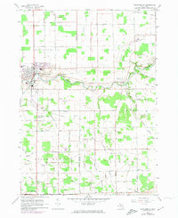
1963 Map of Frankenmuth
USGS Topo · Published 1964About this map
The Cass River winds through the heart of the Saginaw Valley, anchoring a landscape defined by its German heritage and intensive agricultural drainage. This early 1960s survey documents the community of Frankenmuth as it maintains its traditional core, featuring local landmarks like St Lorenz Sch and the High School. The surrounding townships of Birch Run, Tuscola, and Arbela are crisscrossed by an intricate network of man-made waterways, such as the Hammond Drain, List Drain, and Schluckbier Drain, which were essential for converting the low-lying terrain into productive farmland. Smaller settlements like Tuscola and Hadstadt appear alongside family-named roads and rural institutions. Significant historical markers, including the Old Indian Treaty Boundary Road, highlight the 19th-century surveying foundations that still dictated the region's movement and property lines a century later.
Find a feature on this map
66 named features on this map. Tap any name to fly to it.
Don’t see what you’re looking for? This feature index may not catch every label — zoom into the map to look around manually.
Map Details
Editions of this 1963 Frankenmuth Map
2 editions found
Other maps of this area

1919 · Saginaw
USGS Topo · 1:62,500

1919 · Burt
USGS Topo · 1:62,500

1920 · Flint
USGS Topo · 1:62,500

1921 · Burt
USGS Topo · 1:62,500

1922 · Flint
USGS Topo · 1:62,500

1941 · Saginaw
USGS Topo · 1:62,500

1943 · Burt
USGS Topo · 1:62,500

1943 · Saginaw
USGS Topo · 1:62,500

1943 · Flint
USGS Topo · 1:62,500

1954 · Flint
USGS Topo · 1:250,000
Featured Places
- Frankenmuth, City of Frankenmuth
- City of Frankenmuth, MI
- Tuscola, MI
- Frankenmuth Township, MI
- Arbela Township, MI