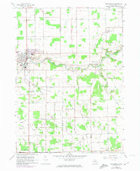
1963 Map of Frankenmuth
USGS Topo · Published 1974About this map
The Cass River carves a winding path through this agricultural landscape, anchoring the settlement of Frankenmuth as it appeared in the early 1960s with updates through the early 1970s. The map illustrates a region defined by its German heritage and rural infrastructure, featuring the St Lorenz Sch and a distinctive Frankenmuth Landing Strip just east of the main town. A significant historical marker, the Old Indian Treaty Boundary, cuts across the northern portion of the quadrangle, serving as a reminder of early land partitions in Michigan.
Find a feature on this map
49 named features on this map. Tap any name to fly to it.
Don’t see what you’re looking for? This feature index may not catch every label — zoom into the map to look around manually.
Map Details
Editions of this 1963 Frankenmuth Map
2 editions found

Other maps of this area

1919 · Saginaw
USGS Topo · 1:62,500

1919 · Burt
USGS Topo · 1:62,500

1920 · Flint
USGS Topo · 1:62,500

1921 · Burt
USGS Topo · 1:62,500

1922 · Flint
USGS Topo · 1:62,500

1941 · Saginaw
USGS Topo · 1:62,500

1943 · Burt
USGS Topo · 1:62,500

1943 · Saginaw
USGS Topo · 1:62,500

1943 · Flint
USGS Topo · 1:62,500

1954 · Flint
USGS Topo · 1:250,000
Featured Places
- Frankenmuth, City of Frankenmuth
- City of Frankenmuth, MI
- Tuscola, MI
- Frankenmuth Township, MI
- Arbela Township, MI