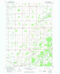
1963 Map of Gilford
USGS Topo · Published 1974About this map
Agricultural fields and a network of drainage ditches like Haines Drain and Northwest Drain dominate this Tuscola County landscape, reflecting the intensive drainage efforts required for farming the Saginaw Bay lowlands. Small crossroads settlements and historic school sites serve as local focal points, including Hobart Sch near Gilford and Tappan Sch further south. The southern reaches of the quadrangle transition into the more varied terrain of the Vassar State Game Area, where the Cass River winds past Odessa Lakes. Transport patterns are defined by the Chesapeake and Ohio and Penn Central rail lines, which historically linked these farming communities to regional markets. Evidence of local industry is visible through numerous Gravel Pits and Sandpits scattered throughout Juniata and Tuscola townships.
Find a feature on this map
45 named features on this map. Tap any name to fly to it.
Don’t see what you’re looking for? This feature index may not catch every label — zoom into the map to look around manually.
Map Details
Editions of this 1963 Gilford Map
2 editions found
Other maps of this area

1954 · Flint
USGS Topo · 1:250,000

1958 · Flint
USGS Topo · 1:250,000

1963 · Quanicassee
USGS Topo · 1:24,000

1963 · Fairgrove
USGS Topo · 1:24,000

1963 · Reese
USGS Topo · 1:24,000

1963 · Gilford
USGS Topo · 1:24,000

1963 · Caro
USGS Topo · 1:24,000

1963 · Frankenmuth
USGS Topo · 1:24,000

1963 · Vassar
USGS Topo · 1:24,000

1963 · Juniata
USGS Topo · 1:24,000