
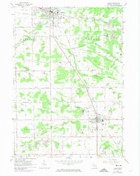
1963 Map of Vassar
USGS Topo · Published 1964About this map
The Cass River winds through the northwestern corner of this territory, anchoring the city of Vassar, while the village of Millington sits toward the southeast. This early 1960s landscape in Tuscola County is defined by a dense network of drainage canals, including Schurtz Drain and Millington Drain, reflecting the area's agricultural reclamation. The transition from active rail to automotive travel is evident in the presence of the Chesapeake and Ohio and New York Central lines alongside an old railroad grade that suggests an even older era of logging or transit.
Find a feature on this map
73 named features on this map. Tap any name to fly to it.
Don’t see what you’re looking for? This feature index may not catch every label — zoom into the map to look around manually.
Map Details
Editions of this 1963 Vassar Map
2 editions found
Other maps of this area

1920 · Flint
USGS Topo · 1:62,500

1922 · Flint
USGS Topo · 1:62,500

1943 · Flint
USGS Topo · 1:62,500

1954 · Flint
USGS Topo · 1:250,000

1958 · Flint
USGS Topo · 1:250,000

1963 · Reese
USGS Topo · 1:24,000

1963 · Columbiaville
USGS Topo · 1:24,000

1963 · Gilford
USGS Topo · 1:24,000

1963 · Caro
USGS Topo · 1:24,000

1963 · Frankenmuth
USGS Topo · 1:24,000