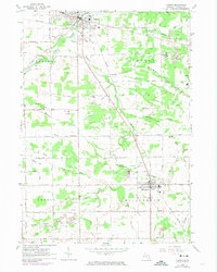
1963 Map of Vassar
USGS Topo · Published 1974About this map
The Cass River winds through the northern portion of this agricultural and industrial landscape, connecting the primary settlements of Vassar and Millington. In the mid-1960s, the region was defined by a complex drainage network, featuring named waterways like Goodings Creek, Perry Creek, and Ellis Drain that supported the surrounding farmland. The industrial character of the area is evident in the numerous Sandpits and Gravel Pits scattered throughout Vassar and Millington townships, particularly near the rail lines. Local transportation and logistics are anchored by the Penn Central and Chesapeake and Ohio railroads, while smaller rural nodes like Brainard and Riverside provide a look at more localized settlement patterns. Community life is anchored by landmarks such as the Mennonite Mission and several rural schoolhouses, including Chadwick Sch and Pinkerton Sch.
Find a feature on this map
59 named features on this map. Tap any name to fly to it.
Don’t see what you’re looking for? This feature index may not catch every label — zoom into the map to look around manually.
Map Details
Editions of this 1963 Vassar Map
2 editions found

Other maps of this area

1920 · Flint
USGS Topo · 1:62,500

1922 · Flint
USGS Topo · 1:62,500

1943 · Flint
USGS Topo · 1:62,500

1954 · Flint
USGS Topo · 1:250,000

1958 · Flint
USGS Topo · 1:250,000

1963 · Reese
USGS Topo · 1:24,000

1963 · Columbiaville
USGS Topo · 1:24,000

1963 · Gilford
USGS Topo · 1:24,000

1963 · Caro
USGS Topo · 1:24,000

1963 · Frankenmuth
USGS Topo · 1:24,000