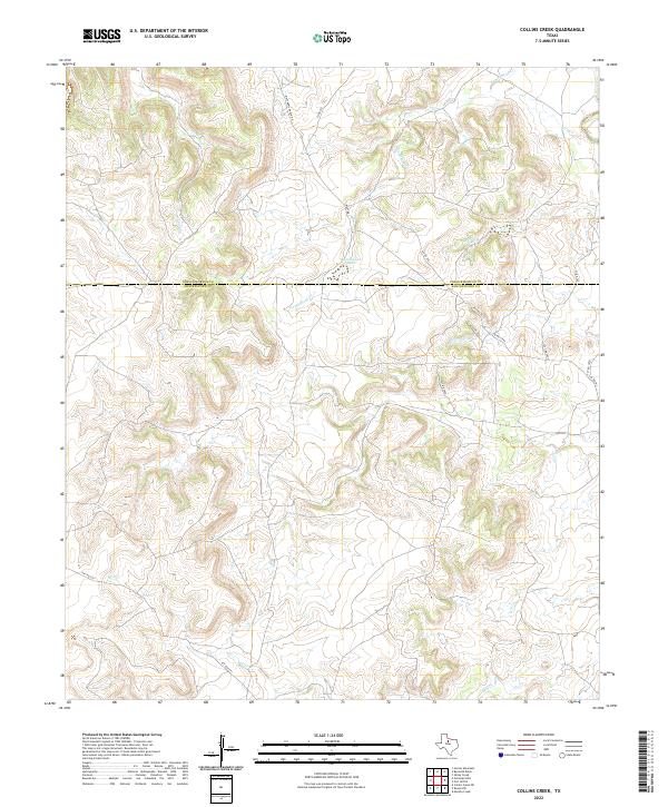
2022 Map of Collins Creek
USGS Topo · Published 2022About this map
Lambshead Cr and its tributaries wind through this ranchland terrain along the border of Throckmorton and Shackelford counties. The landscape is defined by its drainages, including Walnut Cr in the northwest and Jackson Br and Reynolds Br further east. A network of private and county roads, such as Matthews Ranch Rd and Watt Rd, provides access across the expansive acreage, which is dotted with water management features like Lambshead Tank. In the southern portion of the map, Mill Cr cuts across the territory near Pvt Rd 2271. This 2022 survey illustrates the persistent rural character of the Texas Rolling Plains, where large-scale ranching operations and localized infrastructure remain the dominant features of the human and physical environment.
Find a feature on this map
18 named features on this map. Tap any name to fly to it.
Don’t see what you’re looking for? This feature index may not catch every label — zoom into the map to look around manually.
Map Details
Editions of this 2022 Collins Creek Map
This is the sole edition of this map. No revisions or reprints were ever made.
Other maps of this area

1892 · Albany
USGS Topo · 1:125,000

1893 · Albany
USGS Topo · 1:125,000

1954 · Abilene
USGS Topo · 1:250,000

1954 · Wichita Falls
USGS Topo · 1:250,000

1958 · Wichita Falls
USGS Topo · 1:250,000

1958 · Abilene
USGS Topo · 1:250,000

1965 · Collins Creek
USGS Topo · 1:24,000
1965 · Collins Creek SW
USGS Topo · 1:24,000
1965 · Antelope Hills
USGS Topo · 1:24,000

1965 · Fort Griffin
USGS Topo · 1:24,000