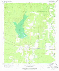
1960 Map of Collins
USGS Topo · Published 1977About this map
Seven Devils Lake and the wetlands of the Cutoff Creek drainage dominate the center of this Drew County landscape, which was surveyed at the dawn of the 1960s. The settlement of Collins sits as a vital junction between the Missouri Pacific railroad and local roads, serving as a hub for the surrounding agricultural districts of Franklin, Cominto, and Bartholomew. To the east, Bayou Bartholomew meanders through the lowlands, creating a distinct hydrological border marked by features like Northern Brake and Fourmile Creek.
Find a feature on this map
21 named features on this map. Tap any name to fly to it.
Don’t see what you’re looking for? This feature index may not catch every label — zoom into the map to look around manually.
Map Details
Editions of this 1960 Collins Map
2 editions found

Other maps of this area

1935 · Mist
USGS Topo · 1:62,500

1935 · Cominto
USGS Topo · 1:62,500

1936 · McGehee
USGS Topo · 1:62,500

1936 · Lake Village
USGS Topo · 1:62,500

1937 · McGehee
USGS Topo · 1:62,500

1953 · Greenwood
USGS Topo · 1:250,000

1955 · Lake Village
USGS Topo · 1:62,500

1955 · McGehee
USGS Topo · 1:62,500

1956 · Greenwood
USGS Topo · 1:250,000

1960 · Mist
USGS Topo · 1:62,500