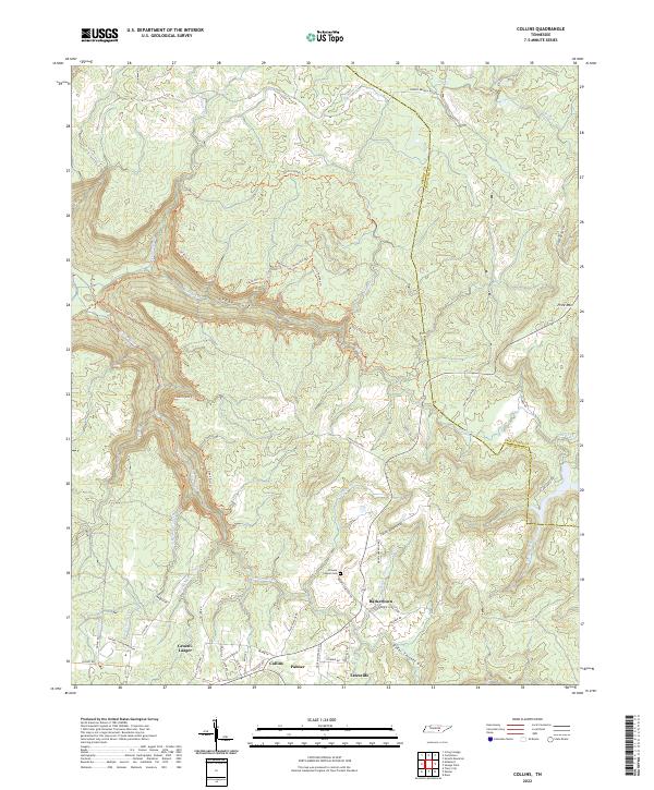
2022 Map of Collins
USGS Topo · Published 2022About this map
Gruetli-Laager and the surrounding plateau communities of Palmer, Collins, and Tatesville sit at the southern edge of this modern survey. The map details a dramatic landscape defined by the deep incisions of Savage Gulf and Elder Thicket Gulf, where the Middle Prong Collins River and Savage Cr have carved through the Cumberland Plateau. This area, spanning the border of Grundy and Sequatchie counties, shows a mix of historical settlement patterns and rugged conservation land. Local history is anchored by landmarks like Browns Chapel Cem and Barkertown, while an extensive network of footpaths including the North Plateau Trl and Collins Gulf Trl provide access to the plateau's interior. The presence of Stage Coach Rd serves as a reminder of early transit routes through this complex terrain between Price Mtn and Round Mountain.
Find a feature on this map
61 named features on this map. Tap any name to fly to it.
Don’t see what you’re looking for? This feature index may not catch every label — zoom into the map to look around manually.
Map Details
Editions of this 2022 Collins Map
This is the sole edition of this map. No revisions or reprints were ever made.
Other maps of this area

1888 · Chattanooga
USGS Topo · 1:125,000

1892 · Pikeville
USGS Topo · 1:125,000

1893 · Mc Minnville
USGS Topo · 1:125,000

1893 · Chattanooga
USGS Topo · 1:125,000

1895 · Mc Minnville
USGS Topo · 1:125,000

1895 · Sewanee
USGS Topo · 1:125,000

1895 · Pikeville
USGS Topo · 1:125,000

1935 · Smart Mountain
USGS Topo · 1:24,000

1936 · Palmer
USGS Topo · 1:24,000

1936 · Daus
USGS Topo · 1:24,000