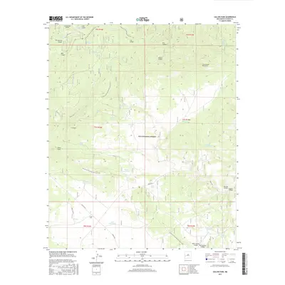
2017 Map of Collins Park
USGS Topo · Published 2017About this map
Collins Park serves as a central hub in this high-altitude landscape within the Gila National Forest. The geography is defined by a complex network of canyons and mountains, such as the Long Canyon Mountains and Sawmill Canyon, which historically shaped travel and ranching patterns. A significant portion of the Continental Divide National Scenic Trail winds through the terrain, passing near landmarks like Pinon Knob and Ghost Lake. The map reveals a land heavily managed for water resources, with numerous named tanks and springs, including Dutchman Spring and Sheep Camp Tank, indicating the area's ongoing importance for livestock and wildlife. Forestry access is maintained via Bursum Rd and Forest Rd 94, which connect these remote basins and ridges.
Find a feature on this map
48 named features on this map. Tap any name to fly to it.
Don’t see what you’re looking for? This feature index may not catch every label — zoom into the map to look around manually.
Map Details
Editions of this 2017 Collins Park Map
This is the sole edition of this map. No revisions or reprints were ever made.
Other maps of this area

1915 · Reserve
USGS Topo · 1:125,000

1918 · Pelona
USGS Topo · 1:125,000

1918 · Reserve
USGS Topo · 1:125,000

1954 · Clifton
USGS Topo · 1:250,000

1957 · Clifton
USGS Topo · 1:250,000

1958 · Clifton
USGS Topo · 1:250,000

1962 · Clifton
USGS Topo · 1:250,000
1963 · Pitchfork Canyon
USGS Topo · 1:24,000
1963 · Telephone Canyon
USGS Topo · 1:24,000
1965 · Eagle Peak
USGS Topo · 1:24,000