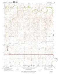
1979 Map of Collyer
USGS Topo · Published 1979About this map
The Saline River winds across the northern landscape of Trego County, defining the drainage patterns for this High Plains region in the late 1970s. The settlement of Collyer serves as a primary hub, positioned where the infrastructure of the Union Pacific railroad and major highways, including routes 70 and 40, intersect. The map illustrates a transition from the riparian environment of the river valley to the industrial and agricultural uplands, marked by several Oil Wells and a Sandpit in the central sections. Further east along the rail line, smaller points of interest like Voda and Voda 2 provide specific locations for genealogists or historians tracing the development of rail sidings and rural communities. Tributaries such as Coyote Creek and Trego Creek carve through the terrain, illustrating the natural watercourses that historically influenced local land use.
Find a feature on this map
13 named features on this map. Tap any name to fly to it.
Don’t see what you’re looking for? This feature index may not catch every label — zoom into the map to look around manually.
Map Details
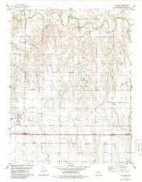
Editions of this 1979 Collyer Map
2 editions found
Other maps of this area

1893 · Ellis
USGS Topo · 1:125,000

1893 · Hill
USGS Topo · 1:125,000

1954 · Goodland
USGS Topo · 1:250,000

1955 · Great Bend
USGS Topo · 1:250,000

1955 · Scott City
USGS Topo · 1:250,000

1955 · Beloit
USGS Topo · 1:250,000

1956 · Goodland
USGS Topo · 1:250,000

1957 · Goodland
USGS Topo · 1:250,000

1957 · Great Bend
USGS Topo · 1:250,000

1958 · Great Bend
USGS Topo · 1:250,000