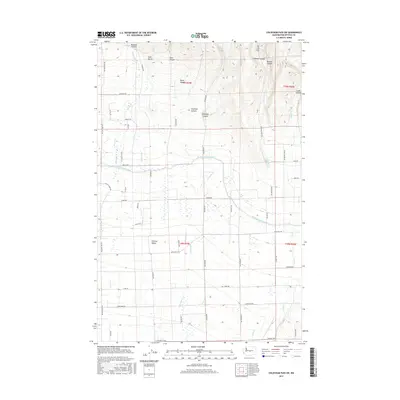
2017 Map of Colockum Pass SW
USGS Topo · Published 2017About this map
Kittitas Valley is defined by a rigorous grid of section lines and irrigation infrastructure in the south, transitioning into a landscape of deep canyons as the elevation rises to the north. The North Branch Canal serves as the primary boundary between the fertile valley floor and the rising foothills, where watercourses like Naneum Cr and Schnebly Cr have carved distinct paths. This survey captures the intersection of agricultural utility and natural drainage, where named routes such as Brick Mill Rd and Game Farm Rd provide access to the various farmsteads and ranches. To the north, the terrain becomes increasingly complex, marked by a series of parallel drainage features including Naneum Canyon, Schnebly Canyon, and Burnt Canyon. These landforms dictate the placement of rural roads like Wilson Creek Rd and Coleman Creek Rd which navigate the base of the ridges.
Find a feature on this map
54 named features on this map. Tap any name to fly to it.
Don’t see what you’re looking for? This feature index may not catch every label — zoom into the map to look around manually.
Map Details
Editions of this 2017 Colockum Pass SW Map
This is the sole edition of this map. No revisions or reprints were ever made.
Other maps of this area

1897 · Mount Stuart
USGS Topo · 1:125,000

1899 · Ellensburg
USGS Topo · 1:125,000

1901 · Ellensburg
USGS Topo · 1:125,000

1902 · Mount Stuart
USGS Topo · 1:125,000

1920 · Colockum Pass
USGS Topo · 1:125,000

1922 · Colockum Pass
USGS Topo · 1:125,000

1938 · Badger Pocket
USGS Topo · 1:48,000

1943 · Badger Pocket
USGS Topo · 1:62,500

1950 · Yakima
USGS Topo · 1:250,000
1953 · East Kittitas
USGS Topo · 1:24,000