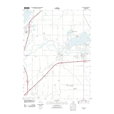
2011 Map of Coloma
USGS Topo · Published 2011About this map
Paw Paw Lake and the meandering Paw Paw River anchor this southwest Michigan landscape, where the neighboring communities of Coloma and Watervliet developed along the water. The map documents a high density of rural burial grounds that speak to the area's ancestral roots, including the Harris Cemetery, Boyer Cemetery, and the Kniebes Cemetery south of the river. Aviation and recreation play visible roles in the local economy, from the Watervliet Municipal Airport and Ringer Landing Strip to the Benton Harbor/Saint Joseph KOA Campground near the coast.
Find a feature on this map
77 named features on this map. Tap any name to fly to it.
Don’t see what you’re looking for? This feature index may not catch every label — zoom into the map to look around manually.
Map Details
Editions of this 2011 Coloma Map
This is the sole edition of this map. No revisions or reprints were ever made.
Other maps of this area

1927 · Hartford
USGS Topo · 1:62,500

1927 · Bangor
USGS Topo · 1:62,500

1927 · Benton Harbor
USGS Topo · 1:62,500

1927 · South Haven
USGS Topo · 1:62,500

1930 · South Haven
USGS Topo · 1:62,500

1930 · Benton Harbor
USGS Topo · 1:62,500

1931 · Bangor
USGS Topo · 1:62,500

1931 · Hartford
USGS Topo · 1:62,500

1943 · South Haven
USGS Topo · 1:62,500

1943 · Bangor
USGS Topo · 1:62,500