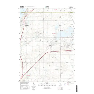
2017 Map of Coloma
USGS Topo · Published 2017About this map
The Paw Paw River winds through this Berrien County landscape, connecting the resort-oriented waters of Paw Paw Lake and Little Paw Paw Lake to the industrial and agricultural corridors of Coloma and Watervliet. The map documents a region defined by its proximity to Lake Michigan, where the community of Lake Michigan Beach sits atop the coastal bluffs.
Find a feature on this map
180 named features on this map. Tap any name to fly to it.
Don’t see what you’re looking for? This feature index may not catch every label — zoom into the map to look around manually.
Map Details
Editions of this 2017 Coloma Map
This is the sole edition of this map. No revisions or reprints were ever made.
Other maps of this area

1927 · Hartford
USGS Topo · 1:62,500

1927 · Bangor
USGS Topo · 1:62,500

1927 · Benton Harbor
USGS Topo · 1:62,500

1927 · South Haven
USGS Topo · 1:62,500

1930 · South Haven
USGS Topo · 1:62,500

1930 · Benton Harbor
USGS Topo · 1:62,500

1931 · Bangor
USGS Topo · 1:62,500

1931 · Hartford
USGS Topo · 1:62,500

1943 · South Haven
USGS Topo · 1:62,500

1943 · Bangor
USGS Topo · 1:62,500