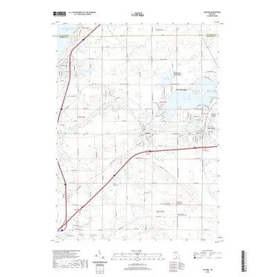
2019 Map of Coloma
USGS Topo · Published 2019About this map
Coloma and Watervliet anchor this Berrien County landscape where the Paw Paw River winds through a series of significant inland lakes. The geography is defined by the expansive Paw Paw Lake and its smaller neighbor, Little Paw Paw Lake, which historically drove the area's development as a regional destination. A high concentration of family and denominational burial grounds, including Boyer Cem, Kniebes Cem, and Harris Cem, provides deep genealogical context for the surrounding agricultural tracts. The infrastructure of the late 20th and early 21st centuries is evident in the path of the Red Arrow Hwy and Blue Star Hwy, which run alongside older local routes like Territorial Rd. Near the eastern edge, the Watervliet Municipal Airport sits just north of Mill Creek, marking the intersection of modern transport and the traditional river-and-rail corridor.
Find a feature on this map
92 named features on this map. Tap any name to fly to it.
Don’t see what you’re looking for? This feature index may not catch every label — zoom into the map to look around manually.
Map Details
Editions of this 2019 Coloma Map
This is the sole edition of this map. No revisions or reprints were ever made.
Other maps of this area

1927 · Hartford
USGS Topo · 1:62,500

1927 · Bangor
USGS Topo · 1:62,500

1927 · Benton Harbor
USGS Topo · 1:62,500

1927 · South Haven
USGS Topo · 1:62,500

1930 · South Haven
USGS Topo · 1:62,500

1930 · Benton Harbor
USGS Topo · 1:62,500

1931 · Bangor
USGS Topo · 1:62,500

1931 · Hartford
USGS Topo · 1:62,500

1943 · South Haven
USGS Topo · 1:62,500

1943 · Bangor
USGS Topo · 1:62,500