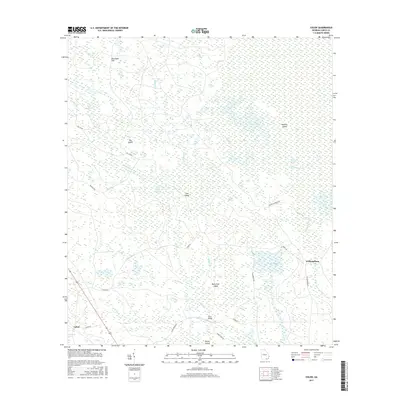
2017 Map of Colon
USGS Topo · Published 2017About this map
Okefenokee Swamp dominates the eastern expanse of this South Georgia landscape, where the flat, watery terrain is punctuated by slightly elevated sand features and islands. The settlement of Colon sits in the southwest corner near Sawgrass Pond, while the community of Williamsburg is situated to the east. This 2017 survey reveals an intricate network of waterways including Alligator Cr and Tatum Cr, which drain through various wetlands like Indian Swamp and Cross Swamp. Significant topographic rises appear as named islands within the marshes, notably Big Island, Cub Island, and Buck Trail Island. A lattice of forest and service roads, such as Tower Rd and Score Bridge Rd, provides the primary access through this hydrologically complex environment, connecting remote points like Score Bridge to the small rural centers.
Find a feature on this map
32 named features on this map. Tap any name to fly to it.
Don’t see what you’re looking for? This feature index may not catch every label — zoom into the map to look around manually.
Map Details
Editions of this 2017 Colon Map
This is the sole edition of this map. No revisions or reprints were ever made.
Other maps of this area

1954 · Valdosta
USGS Topo · 1:250,000

1958 · Valdosta
USGS Topo · 1:250,000

1959 · Valdosta
USGS Topo · 1:250,000

1966 · The Pocket
USGS Topo · 1:24,000

1966 · Cravens Island
USGS Topo · 1:24,000

1967 · Strange Island
USGS Topo · 1:24,000

1967 · Spooner
USGS Topo · 1:24,000

1967 · Colon
USGS Topo · 1:24,000

1967 · Fargo
USGS Topo · 1:24,000

1968 · Midway
USGS Topo · 1:24,000