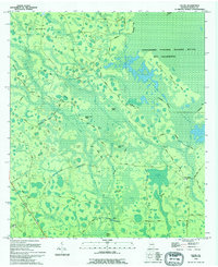
1994 Map of Colon
USGS Topo · Published 1994About this map
The Okefenokee National Wildlife Refuge and Wilderness dominates this landscape in southern Georgia, where a complex network of dry land "islands" rises from the swampy lowlands. Features such as Big Island, Cribbs Island, and Dead Cow Island are connected by a web of primitive roads and trackways, including the Swamp Perimeter Road and Old Leo Road. This mapping reflects a 1993 field revision, detailing the transition from the dense wetlands to the settled areas on the western and southern fringes.
Find a feature on this map
41 named features on this map. Tap any name to fly to it.
Don’t see what you’re looking for? This feature index may not catch every label — zoom into the map to look around manually.
Map Details
Editions of this 1994 Colon Map
This is the sole edition of this map. No revisions or reprints were ever made.
Other maps of this area

1954 · Valdosta
USGS Topo · 1:250,000

1958 · Valdosta
USGS Topo · 1:250,000

1959 · Valdosta
USGS Topo · 1:250,000

1966 · The Pocket
USGS Topo · 1:24,000

1966 · Cravens Island
USGS Topo · 1:24,000

1967 · Strange Island
USGS Topo · 1:24,000

1967 · Spooner
USGS Topo · 1:24,000

1967 · Colon
USGS Topo · 1:24,000

1967 · Fargo
USGS Topo · 1:24,000

1968 · Midway
USGS Topo · 1:24,000