1963 Map of Colona
USGS Topo · Published 1970About this map
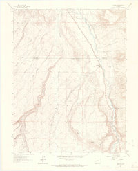
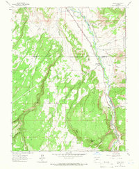
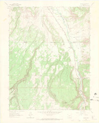
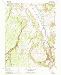
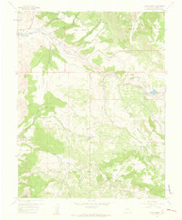
Colona sits as a primary valley settlement along the Uncompahgre River, serving as a focal point where the Denver and Rio Grande Western railroad tracks parallel the water's course. This early 1960s survey illustrates a landscape defined by the transition from the irrigated river bottom to the high elevations of Log Hill Mesa and Piñon Ridge. The complexity of local water management is evident through the engineered paths of the South Canal, West Canal, and the Mc Donald Ditch, which redirect water across the arid terrain.
Find a feature on this map
32 named features on this map. Tap any name to fly to it.
Don’t see what you’re looking for? This feature index may not catch every label — zoom into the map to look around manually.
Map Details
Editions of this 1963 Colona Map
4 editions found
Other maps of this area

1902 · Ouray
USGS Topo · 1:62,500

1904 · Ouray
USGS Topo · 1:62,500

1909 · Montrose
USGS Topo · 1:125,000

1911 · Montrose
USGS Topo · 1:125,000

1956 · Montrose
USGS Topo · 1:250,000
1957 · Cerro Summit
USGS Topo · 1:24,000

1959 · Montrose
USGS Topo · 1:250,000

1960 · Montrose
USGS Topo · 1:250,000
1962 · Montrose East
USGS Topo · 1:24,000
1962 · Montrose West
USGS Topo · 1:24,000