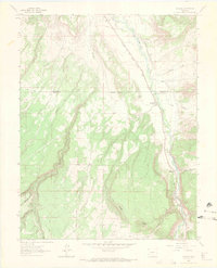
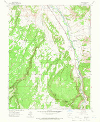
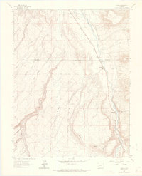
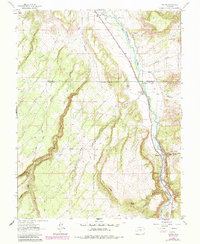
1963 Map of Colona
USGS Topo · Published 1970About this map
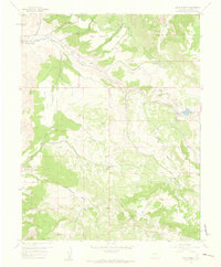
Colona sits along the banks of the Uncompahgre River, serving as a central hub where the Denver and Rio Grande Western railroad tracks parallel the water. The settlement's infrastructure in the early 1960s included the Colona Cem and a Gaging Sta, while the surrounding landscape is defined by the massive plateau of Log Hill Mesa and the sharp rise of Piñon Ridge.
Find a feature on this map
29 named features on this map. Tap any name to fly to it.
Don’t see what you’re looking for? This feature index may not catch every label — zoom into the map to look around manually.
Map Details
Editions of this 1963 Colona Map
4 editions found
Other maps of this area

1902 · Ouray
USGS Topo · 1:62,500

1904 · Ouray
USGS Topo · 1:62,500

1909 · Montrose
USGS Topo · 1:125,000

1911 · Montrose
USGS Topo · 1:125,000

1956 · Montrose
USGS Topo · 1:250,000
1957 · Cerro Summit
USGS Topo · 1:24,000

1959 · Montrose
USGS Topo · 1:250,000

1960 · Montrose
USGS Topo · 1:250,000
1962 · Montrose East
USGS Topo · 1:24,000
1962 · Montrose West
USGS Topo · 1:24,000