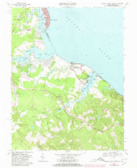
1968 Map of Colonial Beach South
USGS Topo · Published 1980About this map
The George Washington Birthplace National Monument dominates this coastal landscape along the Potomac River, preserving the historic grounds of the Wakefield Mansion and nearby Dancing Marsh. The map reveals a transition from the structured street grid of Colonial Beach, with its prominent Filtration Plant and municipal layout, to the agrarian and maritime reaches of Westmoreland County. Small communities and family-named landmarks like Monroe Hall, Latanes, and Morris Store are connected by winding roads through extensive swamp networks, including Popes Creek Swamp and Bundys Swamp. Evidence of local industry and infrastructure appears in the Potomac Mills area and the scattered Gravel Pit sites, while the shoreline is defined by numerous points and coves such as Gum Bar Point and Burnt House Cove. The presence of several historic houses of worship, including Monrovia Ch and Popes Creek Ch, reflects the established rural community structure of the late 1960s.
Find a feature on this map
80 named features on this map. Tap any name to fly to it.
Don’t see what you’re looking for? This feature index may not catch every label — zoom into the map to look around manually.
Map Details
Editions of this 1968 Colonial Beach South Map
4 editions found
Other maps of this area

1889 · Fredericksburg
USGS Topo · 1:125,000

1892 · Fredericksburg
USGS Topo · 1:125,000

1892 · Montross
USGS Topo · 1:62,500

1894 · Wicomico
USGS Topo · 1:62,500

1894 · Fredericksburg
USGS Topo · 1:125,000

1895 · Wicomico
USGS Topo · 1:62,500

1895 · Nomini
USGS Topo · 1:125,000

1895 · Montross
USGS Topo · 1:62,500

1898 · Nomini
USGS Topo · 1:125,000

1902 · Wicomico
USGS Topo · 1:62,500