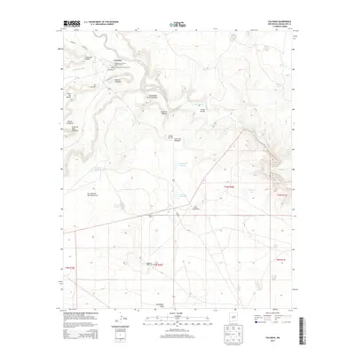
2013 Map of Colonias
USGS Topo · Published 2013About this map
The Pecos River carves a winding path through this portion of Guadalupe County, defining a landscape where historic Hispanic settlements and ranching traditions endure. The village of Colonias serves as a focal point, encompassing the Colonias de San Jose Historic District and the La Placita de Abajo Historic District, which preserve the architectural and cultural heritage of the Pecos Valley. Surrounding these districts, small clusters of habitation like Casas del Medio and El Cerrito sit near the river's edge, shadowed by the dramatic rise of Mesa del Medio and Mesita Cortada.
Find a feature on this map
34 named features on this map. Tap any name to fly to it.
Don’t see what you’re looking for? This feature index may not catch every label — zoom into the map to look around manually.
Map Details
Editions of this 2013 Colonias Map
This is the sole edition of this map. No revisions or reprints were ever made.
Other maps of this area

1892 · Corazon
USGS Topo · 1:125,000

1894 · Corazon
USGS Topo · 1:125,000

1954 · Santa Fe
USGS Topo · 1:250,000

1954 · Fort Sumner
USGS Topo · 1:250,000

1958 · Fort Sumner
USGS Topo · 1:250,000

1958 · Santa Fe
USGS Topo · 1:250,000

1963 · Colonias
USGS Topo · 1:24,000

1963 · Santa Rosa
USGS Topo · 1:24,000

1963 · Pedro Miguel Peak
USGS Topo · 1:24,000
1963 · Horse Pasture Tank
USGS Topo · 1:24,000