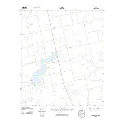
2010 Map of Colorado City SE
USGS Topo · Published 2010About this map
Champion Creek Reservoir dominates the landscape of Mitchell County in this early 21st-century survey, its fingers reaching into the surrounding Texas plains. The reservoir is anchored by the Champion Creek Dam, while the broader terrain is defined by the winding courses of North Fork Champion Creek and South Fork Champion Creek. To the west, the Colorado River cuts through the territory, joined by smaller tributaries like Jayhawk Creek. This survey captures the rural infrastructure of the region, featuring landmarks such as the Jayhawk Windmill and a dense network of county roads like Co RD 117 and Co RD 123 that segment the ranchland into a geometric grid typical of West Texas.
Find a feature on this map
33 named features on this map. Tap any name to fly to it.
Don’t see what you’re looking for? This feature index may not catch every label — zoom into the map to look around manually.
Map Details
Editions of this 2010 Colorado City SE Map
This is the sole edition of this map. No revisions or reprints were ever made.
Other maps of this area

1950 · Cedar Bend
USGS Topo · 1:24,000

1950 · Lake Colorado City
USGS Topo · 1:24,000

1950 · Colorado City SE
USGS Topo · 1:24,000

1952 · Colorado City
USGS Topo · 1:24,000

1954 · Big Spring
USGS Topo · 1:250,000

1958 · Big Spring
USGS Topo · 1:250,000

1959 · Pecan Crossing
USGS Topo · 1:24,000

1959 · Dam Draw
USGS Topo · 1:24,000

1959 · Spade Ranch
USGS Topo · 1:24,000

1969 · Baumann School
USGS Topo · 1:24,000