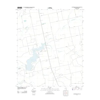
2012 Map of Colorado City SE
USGS Topo · Published 2012About this map
Champion Cr Reservoir dominates this landscape in Mitchell County, providing a central point for water management and recreation in a region defined by seasonal drainage. The hydrology is marked by the convergence of the N Fork Champion Cr and S Fork Champion Cr as they feed into the larger reservoir basin. To the west, the Colorado River meanders through the terrain, creating the prominent Horseshoe Bend as it flows south. The map reflects a predominantly rural and ranching economy, with land divided by a grid of county roads such as Co RD-131 and Co RD-123. Evidence of local infrastructure includes the Jayhawk Windmill near Jayhawk Cr, a traditional landmark of the Texas plains where groundwater management has long been essential for livestock and habitation.
Find a feature on this map
35 named features on this map. Tap any name to fly to it.
Don’t see what you’re looking for? This feature index may not catch every label — zoom into the map to look around manually.
Map Details
Editions of this 2012 Colorado City SE Map
This is the sole edition of this map. No revisions or reprints were ever made.
Other maps of this area

1950 · Cedar Bend
USGS Topo · 1:24,000

1950 · Lake Colorado City
USGS Topo · 1:24,000

1950 · Colorado City SE
USGS Topo · 1:24,000

1952 · Colorado City
USGS Topo · 1:24,000

1954 · Big Spring
USGS Topo · 1:250,000

1958 · Big Spring
USGS Topo · 1:250,000

1959 · Pecan Crossing
USGS Topo · 1:24,000

1959 · Dam Draw
USGS Topo · 1:24,000

1959 · Spade Ranch
USGS Topo · 1:24,000

1969 · Baumann School
USGS Topo · 1:24,000