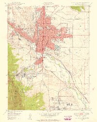
1948 Map of Colorado Springs
USGS Topo · Published 1958About this map
Colorado Springs centers this post-war landscape, showing a period of significant transition as the city expands toward the surrounding foothills. To the north, Roswell and Knob Hill define the urban fringe, while the southern reaches feature established communities like Ivywild and the Broadmoor area. Institutional landmarks are numerous, from the Colorado College campus and the Deaf and Blind Sch to the specialized Union Printers Home and the expansive Camp Carson Military Reservation.
Find a feature on this map
78 named features on this map. Tap any name to fly to it.
Don’t see what you’re looking for? This feature index may not catch every label — zoom into the map to look around manually.
Map Details
Editions of this 1948 Colorado Springs Map
2 editions found
Other maps of this area

1893 · Colorado Springs
USGS Topo · 1:125,000

1909 · Colorado Springs
USGS Topo · 1:125,000

1942 · Colorado Springs
USGS Topo · 1:125,000

1948 · Mount Big Chief
USGS Topo · 1:24,000

1948 · Manitou Springs
USGS Topo · 1:24,000

1948 · Colorado Springs
USGS Topo · 1:62,500

1948 · Pikeview
USGS Topo · 1:24,000

1948 · Cascade
USGS Topo · 1:24,000

1948 · Fountain
USGS Topo · 1:24,000

1948 · Colorado Springs
USGS Topo · 1:24,000
Featured Places
- Colorado Springs, CO
- Security-Widefield, CO
- Knob Hill, Colorado Springs
- Kelker, Colorado Springs
- Fort Carson, CO