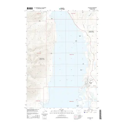
2015 Map of Colter Bay
USGS Topo · Published 2015About this map
Jackson Lake serves as the central focal point for this survey of Grand Teton National Park, defining the landscape of the Teton County backcountry in 2015. The eastern shore is characterized by developed recreational infrastructure around Colter Bay Village, including Leeks Marina Rd and the Colter Bay Campground Rd. In contrast, the western shore remains largely roadless, marked by deep glacial incisions such as Colter Canyon and Webb Canyon. Within the lake itself, several named landforms like Arizona Island and Moose Island are visible alongside the geothermal activity at Jackson Lake Hot Springs. The southern portion of the map reveals the intricate wetlands and smaller water bodies of Swan Lake and Heron Pond, while the northern reaches are accessed by wilderness paths like the Owl Creek Trail.
Find a feature on this map
32 named features on this map. Tap any name to fly to it.
Don’t see what you’re looking for? This feature index may not catch every label — zoom into the map to look around manually.
Map Details
Editions of this 2015 Colter Bay Map
This is the sole edition of this map. No revisions or reprints were ever made.
Other maps of this area

1886 · Shoshone
USGS Topo · 1:125,000

1888 · Shoshone
USGS Topo · 1:125,000

1895 · Shoshone
USGS Topo · 1:125,000

1899 · Grand Teton
USGS Topo · 1:125,000

1901 · Shoshone
USGS Topo · 1:125,000

1901 · Grand Teton
USGS Topo · 1:125,000

1908 · Shoshone
USGS Topo · 1:125,000

1911 · Shoshone
USGS Topo · 1:125,000

1955 · Ashton
USGS Topo · 1:250,000

1955 · Driggs
USGS Topo · 1:250,000