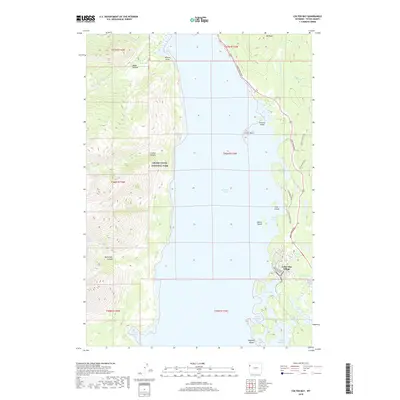
2018 Map of Colter Bay
USGS Topo · Published 2018About this map
Jackson Lake dominates this 2018 survey, providing a clear view of the eastern shoreline and the recreation-rich landscape of Grand Teton National Park. The settlement of Colter Bay Village serves as the primary hub, surrounded by complex aquatic environments including Swan Lake, Heron Pond, and the geothermal activity at Jackson Lake Hot Springs. The map details the intricate network of inlets such as Colter Bay, Sargents Bay, and Pelican Bay, alongside several land masses within the water like Arizona Island and Cow Island.
Find a feature on this map
38 named features on this map. Tap any name to fly to it.
Don’t see what you’re looking for? This feature index may not catch every label — zoom into the map to look around manually.
Map Details
Editions of this 2018 Colter Bay Map
This is the sole edition of this map. No revisions or reprints were ever made.
Other maps of this area

1886 · Shoshone
USGS Topo · 1:125,000

1888 · Shoshone
USGS Topo · 1:125,000

1895 · Shoshone
USGS Topo · 1:125,000

1899 · Grand Teton
USGS Topo · 1:125,000

1901 · Shoshone
USGS Topo · 1:125,000

1901 · Grand Teton
USGS Topo · 1:125,000

1908 · Shoshone
USGS Topo · 1:125,000

1911 · Shoshone
USGS Topo · 1:125,000

1955 · Ashton
USGS Topo · 1:250,000

1955 · Driggs
USGS Topo · 1:250,000