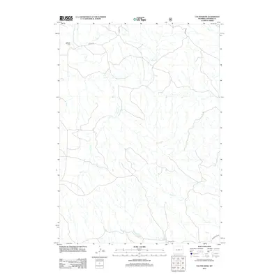
2012 Map of Colter Draw
USGS Topo · Published 2012About this map
Downs Ranch and the Williams Shearing Pens anchor this corner of Wyoming's ranching country in the early twenty-first century. The landscape is defined by a dense network of seasonal and perennial drainages, including the prominent Horse Cr and Willow Cr, which carve through the high plains. Access to these remote homesteads and grazing lands is maintained through a system of forest and county roads, such as Walker Creek Rd and USFS 958 Rd. This survey documents the spatial relationship between traditional livestock operations and the primary waterways like Rat Cr and Bobcat Cr, illustrating the continued importance of water management and land use in Converse County.
Find a feature on this map
12 named features on this map. Tap any name to fly to it.
Don’t see what you’re looking for? This feature index may not catch every label — zoom into the map to look around manually.
Map Details
Editions of this 2012 Colter Draw Map
This is the sole edition of this map. No revisions or reprints were ever made.
Other maps of this area

1955 · Newcastle
USGS Topo · 1:250,000

1958 · Newcastle
USGS Topo · 1:250,000

1970 · Bill 4 SE
USGS Topo · 1:24,000

1970 · Bill 4 NW
USGS Topo · 1:24,000
1970 · Bill 4 SW
USGS Topo · 1:24,000

1970 · Bill 4 NE
USGS Topo · 1:24,000

1971 · Esau Spring
USGS Topo · 1:24,000

1971 · Tin Can Lake
USGS Topo · 1:24,000

1979 · Bill
USGS Topo · 1:100,000

1981 · Pinnacle Rocks
USGS Topo · 1:24,000