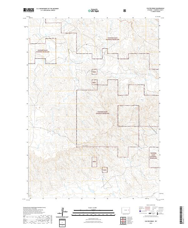
2021 Map of Colter Draw
USGS Topo · Published 2021About this map
Thunder Basin National Grassland dominates this landscape in Converse County, where the high plains are carved by an intricate network of ephemeral drainages. The area is defined by the central depression of Colter Draw and the surrounding high ground of Downs Country. Water is the primary architect here, with Horse Cr, Dry Cr, and Willow Cr creating a complex topography of ridges and draws.
Find a feature on this map
20 named features on this map. Tap any name to fly to it.
Don’t see what you’re looking for? This feature index may not catch every label — zoom into the map to look around manually.
Map Details
Editions of this 2021 Colter Draw Map
This is the sole edition of this map. No revisions or reprints were ever made.
Other maps of this area

1955 · Newcastle
USGS Topo · 1:250,000

1958 · Newcastle
USGS Topo · 1:250,000

1970 · Bill 4 SE
USGS Topo · 1:24,000

1970 · Bill 4 NW
USGS Topo · 1:24,000
1970 · Bill 4 SW
USGS Topo · 1:24,000

1970 · Bill 4 NE
USGS Topo · 1:24,000

1971 · Esau Spring
USGS Topo · 1:24,000

1971 · Tin Can Lake
USGS Topo · 1:24,000

1979 · Bill
USGS Topo · 1:100,000

1981 · Pinnacle Rocks
USGS Topo · 1:24,000