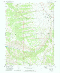
1979 Map of Colton
USGS Topo · Published 1985About this map
Colton serves as the focal point for this high-altitude landscape where the Denver and Rio Grande Western railroad navigates the winding canyon of the Price River. This late 1970s survey captures a transition point between the higher plateaus and the canyon country, marked by heavy industrial and recreational footprints. To the west, the Scofield Lake State Recreation Area provides a contrast to the extractive history suggested by the multiple Quarries and Prospects scattered near the rail line.
Find a feature on this map
24 named features on this map. Tap any name to fly to it.
Don’t see what you’re looking for? This feature index may not catch every label — zoom into the map to look around manually.
Map Details
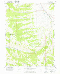
Editions of this 1979 Colton Map
2 editions found
Other maps of this area

1885 · Manti
USGS Topo · 1:250,000

1886 · Price River
USGS Topo · 1:250,000

1895 · Manti
USGS Topo · 1:250,000

1896 · Price River
USGS Topo · 1:250,000

1914 · Castle Gate
USGS Topo · 1:62,500

1916 · Castle Gate
USGS Topo · 1:62,500

1923 · Scofield
USGS Topo · 1:62,500

1925 · Scofield
USGS Topo · 1:62,500

1939 · Soldier Summit
USGS Topo · 1:62,500

1942 · Soldier Summit
USGS Topo · 1:62,500